It’s been 15 days since Hurricane Florence made landfall. The storm landed near Wrightsville Beach, North Carolina as a Category 1 hurricane on Friday, September 14, and for the next week afterward, brought devastating flooding and wind damage to the Carolinas.
Slow-moving Florence brought heavy rainfall in excess of 30 inches to parts of North Carolina. Peak surge from Hurricane Florence reached 10 feet in New Bern, North Carolina, and other areas of the state including Beaufort and Wilmington had significant storm surge impacts.
Now that the damage assessments have begun, RMS, a global risk modeling and analytics firm, has estimated that the insured loss for Hurricane Florence will be between $2.8 billion and $5 billion. This estimate represents insured losses associated with wind, storm surge, and inland flood damage across North Carolina, South Carolina, and Virginia, including losses to the National Flood Insurance Program (NFIP).
In the Carolinas, many residents lack flood insurance, and RMS analysts say 70% of flood losses are expected to be uninsured.
Accounting for uninsured wind, storm surge, and rainfall-driven flood losses in the U.S., RMS expects the overall economic loss from Hurricane Florence to fall between $6.0 billion and $11.0 billion.
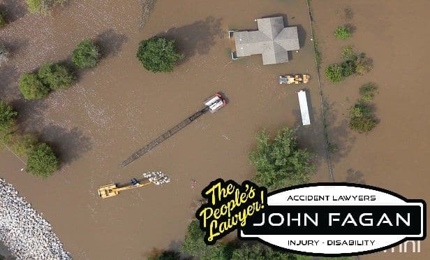
To assess the damage, drone technology provider PrecisionHawk has already begun deploying drones to capture images of the damage and assess insurance claims without actually having to go to the site. Geomni, a Verisk business, is another company that provides multispectral terrestrial imagery and data acquisition, processing, analytics, and distribution.